Current Conditions
♦
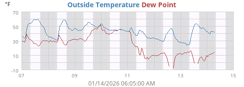
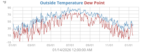
| Outside Temperature | 97.5°F |
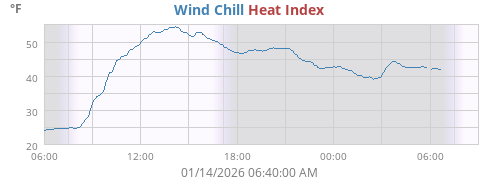
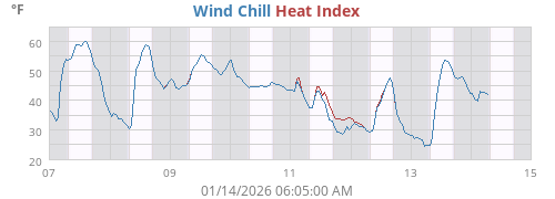
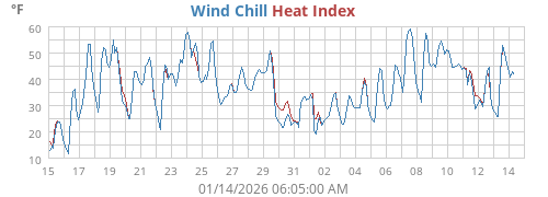
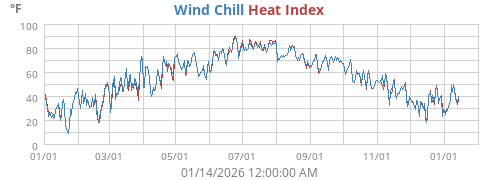
| Heat Index | 97.5°F |
| Wind Chill | 97.5°F |
| Dew Point | 38.8°F |
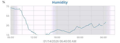
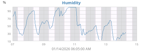
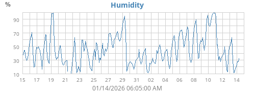
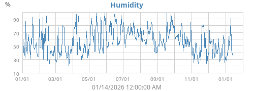
| Humidity | 13% |
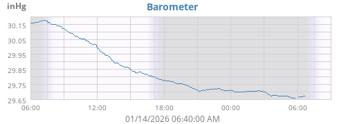
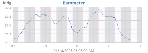
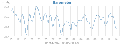
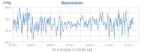
| Barometer | 29.905 inHg (-0.036) |
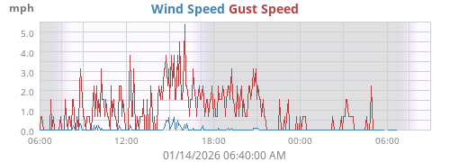
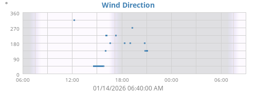
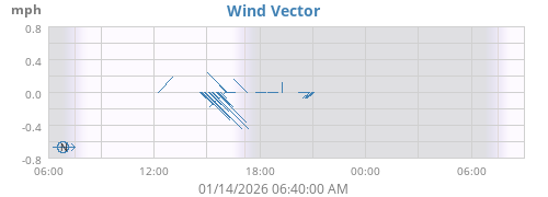
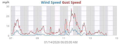
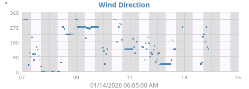
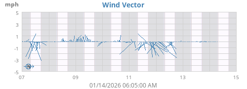
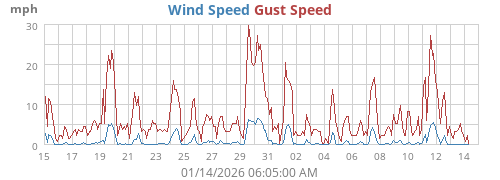
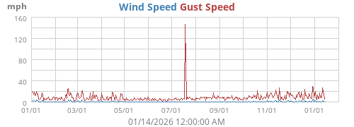
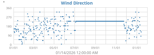
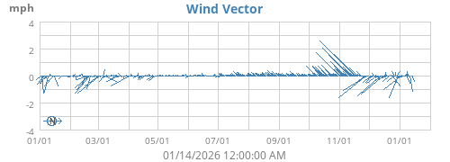
| Wind | 0 mph N/A ( N/A) |
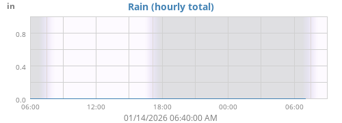
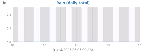
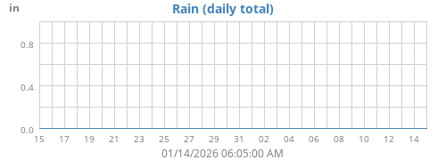
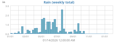
| Rain Rate | 0.00 in/hr |
| Rain Today | 0.00 in |
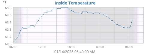
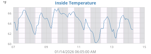
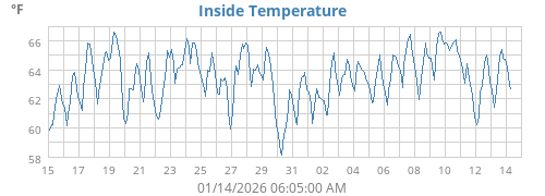
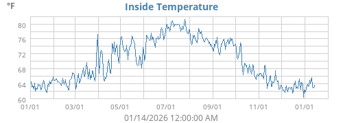
| Inside Temperature | 78.4°F |
| ☀ | ☽ | |||
|---|---|---|---|---|
| Rise | 05:50:52 AM | Rise | 11:51:45 PM | |
| Set | 08:41:23 PM | Set | 11:14:47 AM | |
| Daylight | 14:50 | Last quarter 72% |
| Today |
Week |
Month |
Year |
Rain Year |
||
|---|---|---|---|---|---|---|
| Outside Temperature |
98.2 68.9 |
98.2 68.9 |
106.9 32.0 |
106.9 0.9 |
106.9 0.9 |
°F |
| Heat Index | 98.2 | 98.2 | 105.3 | 105.3 | 105.3 | °F |
| Wind Chill | 68.9 | 68.9 | 32.0 | 0.6 | 0.6 | °F |
| Dew Point |
74.2 32.3 |
74.2 32.3 |
74.2 -20.4 |
78.6 -28.5 |
78.6 -28.5 |
°F |
| Humidity |
99 10 |
99 10 |
99 9 |
99 9 |
99 9 |
% |
| Barometer |
29.968 29.902 |
29.968 29.902 |
30.068 29.819 |
30.646 29.217 |
30.646 29.217 |
inHg |
| Rain | 0.00 | 0.00 | 0.72 | 3.31 | 3.31 | in |
| Rain Rate | 0.00 | 0.00 | 2.36 | 3.35 | 3.35 | in/hr |
| Wind Max |
3 N/A |
3 N/A |
859 N/A |
859 N/A |
859 N/A |
mph ° |
| Wind Average | 0 | 0 | 0 | 1 | 1 | mph |
| Wind RMS | 0 | 0 | 0 | 1 | 1 | mph |
|
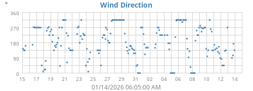
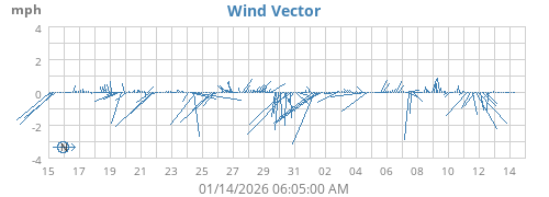
Vector Average Average Direction |
0 90 |
0 90 |
0 43 |
0 116 |
0 116 |
mph ° |
| Inside Temperature |
78.4 75.7 |
78.4 75.7 |
84.6 75.6 |
84.6 59.4 |
84.6 59.4 |
°F |
| Connectivity | |
|---|---|
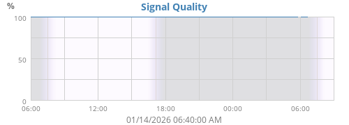
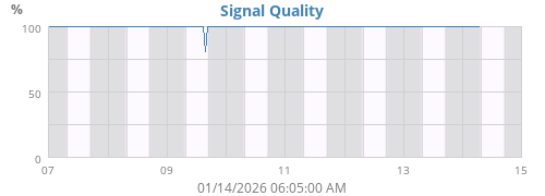
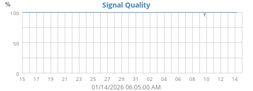
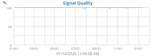
| Signal Quality | 100% |
| Battery Status | |
| Outside Temperature Battery | OK |
About this weather station
♦
| Hardware | WH1080 |
| Latitude | 39° 17.22' N |
| Longitude | 077° 53.98' W |
| Altitude | 572 feet |
| Server uptime | 41 days, 20 hours, 20 minutes |
| WeeWX uptime | 41 days, 20 hours, 20 minutes |
| WeeWX version | 3.9.2 |